|
Book - 2010
 A guide to good practices in identifying and mapping degraded lands. Suceava Plateau Case Study (ro) - Iacobescu Ovidiu, Ionut BARNOAIEA, Radu Leontie CENUSA
Published papers - 2010
Remote Sensing Methods for the Spatial Analysis of Land Degradation Units (Iacobescu, O.; Barnoaiea, I.)
Error assessment in some special traverses measured with total stations (Iacobescu, O.; Barnoaiea, I.)
Aesthetical principles in degraded landscape rehabilitation (Iacobescu, R. M.)
A landscape level assessment of the human impact on terrain – land degradation and ecological rehabilitation (Barnoaiea, I.; Iacobescu, O.; Barnoaiea, A. R.)
Gis database on soil erosion based on digital photogrammetry (Barnoaiea, I.; Iacobescu, O.)
Handbook - 2009
Identifying and mapping degraded lands techniques (ro) (Iacobescu, O.; Barnoaiea, I.)
Presentations at international conference
The use of aerial photos in decision making processes for landscape management (China)
Aerial image use in the spatial variability analysis of degradation forms in North Eastern Romania (Germany)
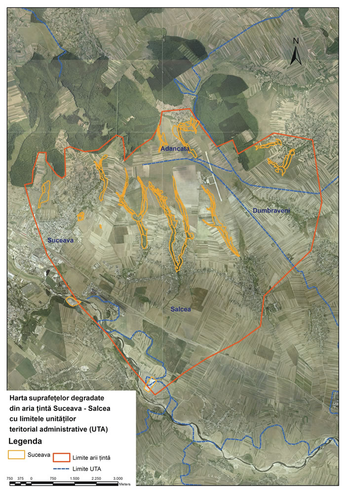
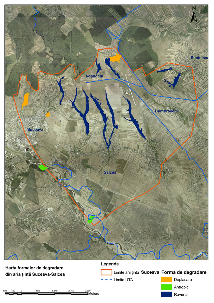
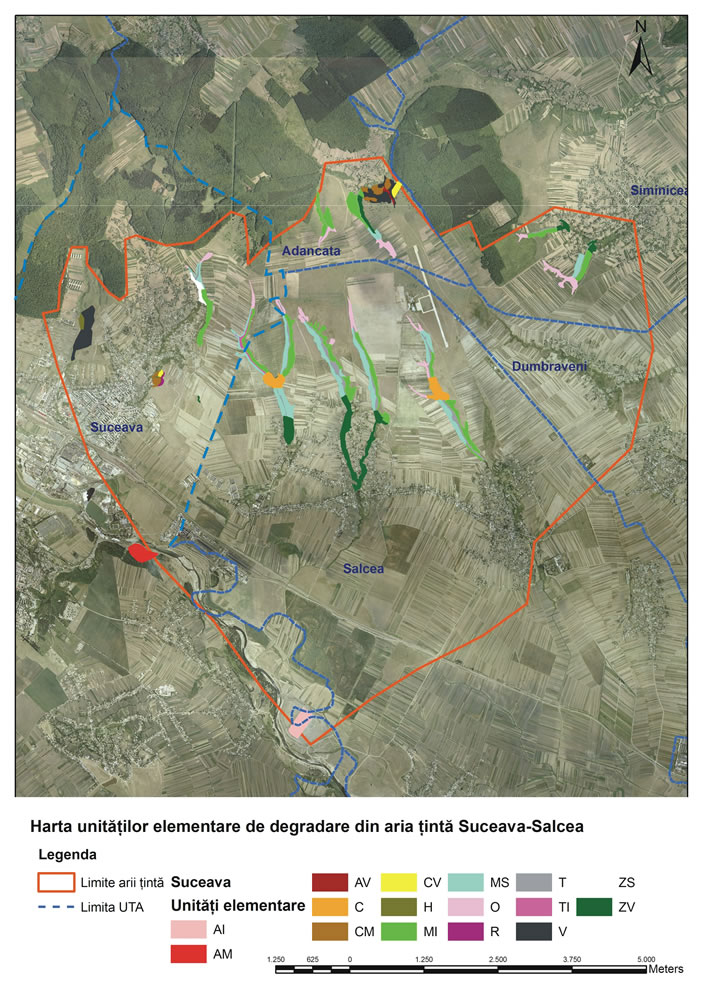
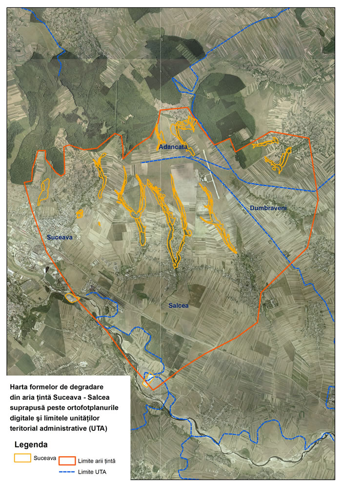
Target area: Suceava-Salcea
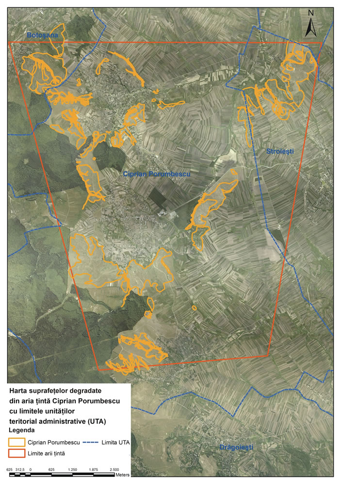
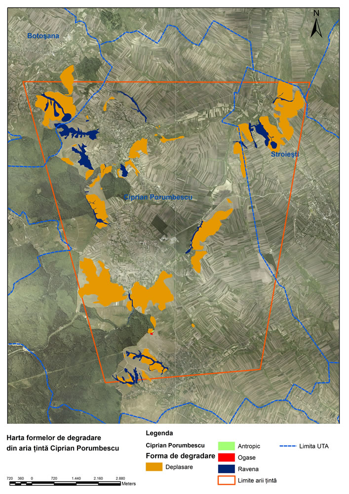
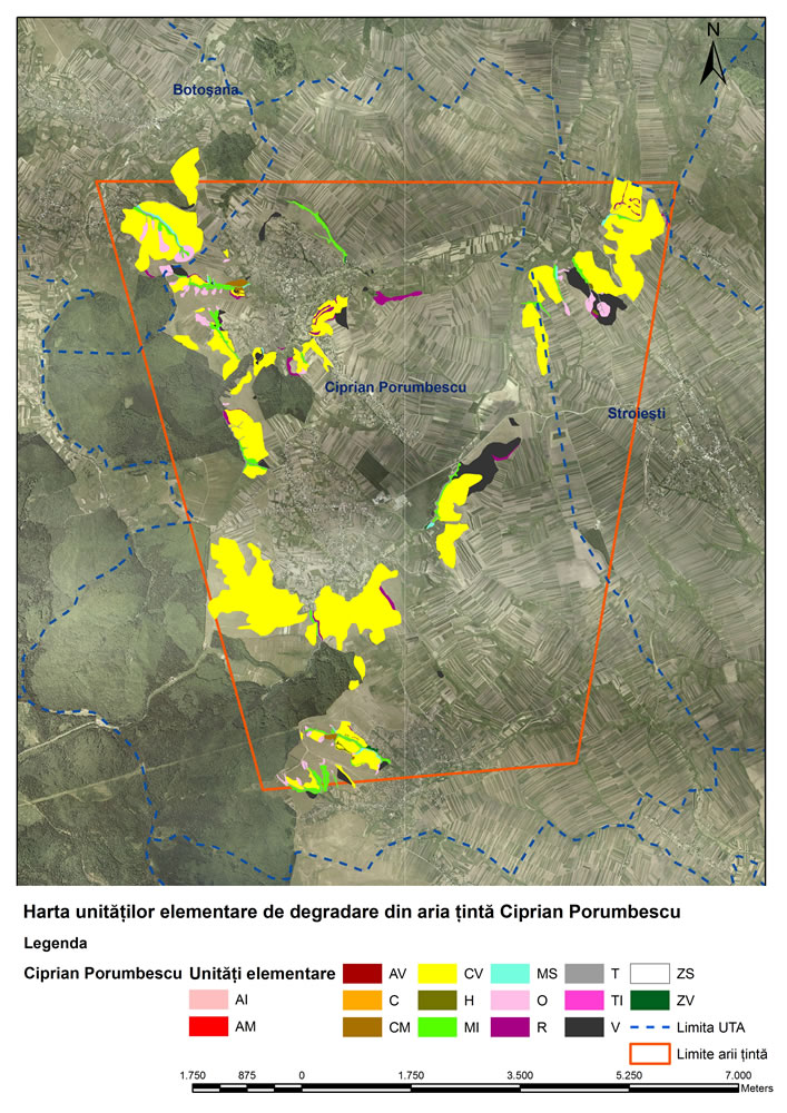
Target area: Ciprian Porumbescu
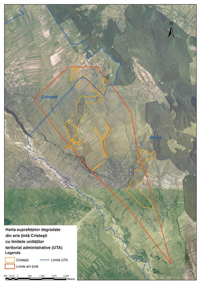
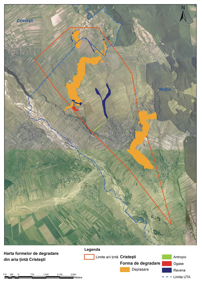
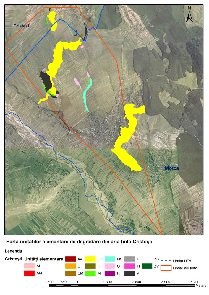
Target area: Cristesti
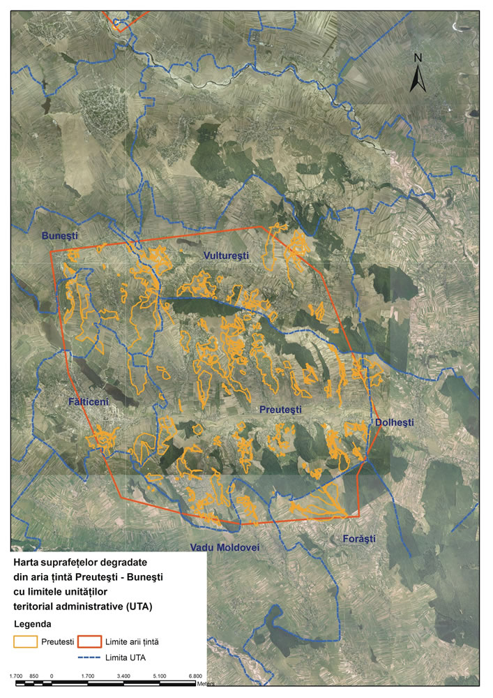
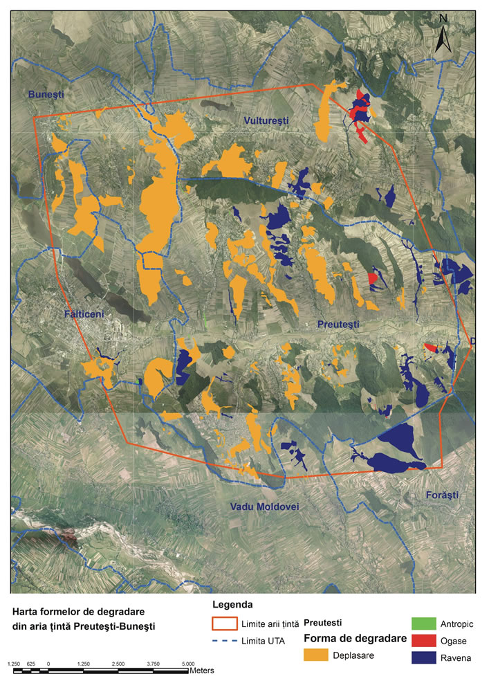
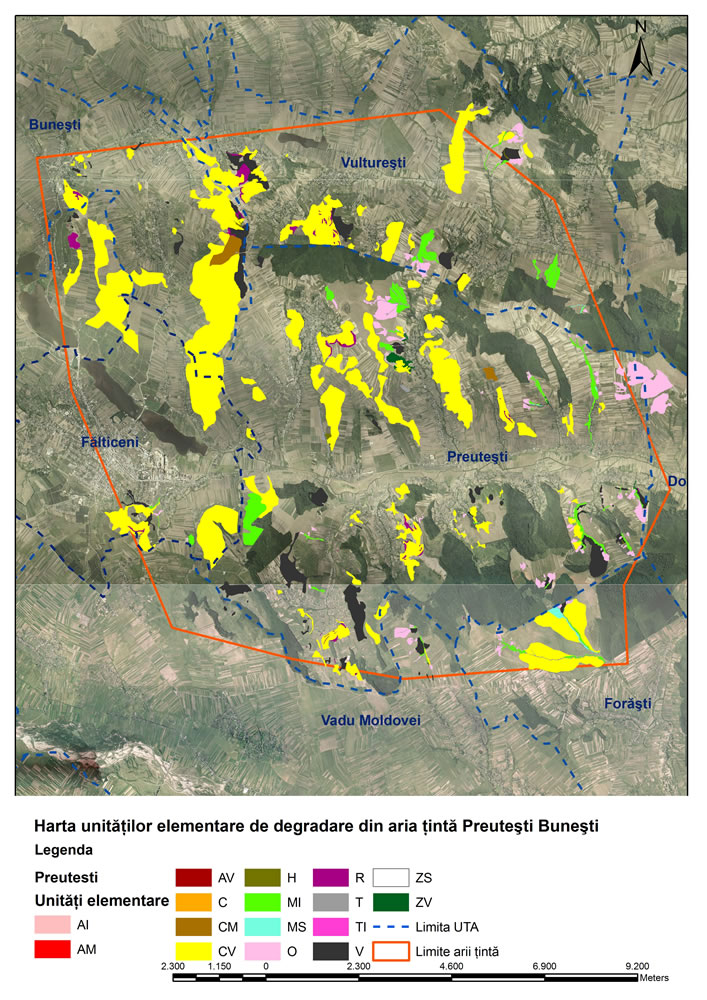
Target area: Preutesti-Bunesti
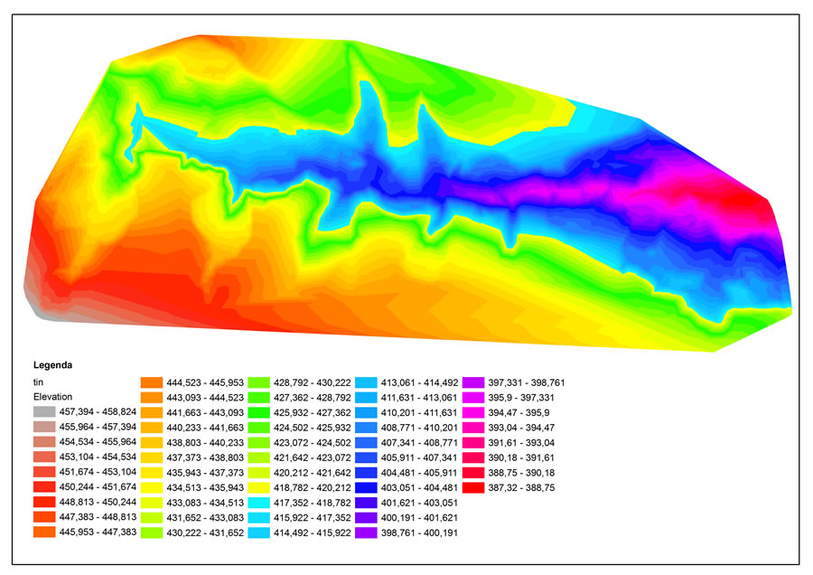
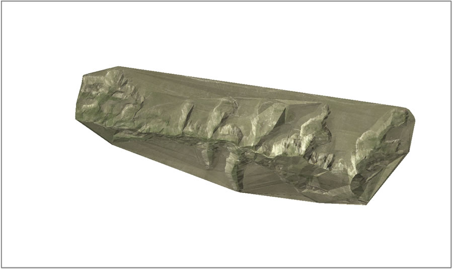
3D model - Balaceana
 |
|
 |
| Elevation model - Balaceana |
|
3D model - Balaceana |
|